News
LBS can change landscape: Land Resources Secretary
The proposed national land-use policy which seeks to regulate land-use efficiently would help in augmenting the use of waste and non-cultivable land and integrating them with location based services (LBS) and would make it easier to update and maintain digitised land records.
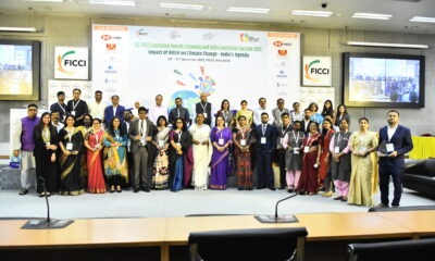
This was stated in New Delhi on Wednesday by Vandana Kumari Jena, Secretary, Department of Land Resources in the Ministry of Rural Development, at a conference on ‘Location Based Services 2015: Transforming Coordinates to Business’ organised by the Federation of Indian Chamber of Commerce and Industries (Ficci) in partnership with the Ministry of Earth Sciences.
Speaking about how LBS could transform India’s landscape, Jena said the Government has been trying to digitise land records of the country and so far 23 states have digitised their records and 24 states have a computerised registration for land. She added that only 10 states have integrated the two systems. Hence, to leverage the true potential of LBS, it was necessary that all the states have real-time information on land records.
On the occasion a FICCI-PwC report, ‘Location Based Services for Smart Cities’ was released by the dignitaries.
The report recommends that in order to mitigate challenges and ensure effective implementation of LBS along with smart city components across cities, there is a need to use LBS during assessment of city master planning; create a single agency for generating, collecting and utilising location and geospatial data of a city and frame a policy for data security and privacy.


Sudhir Krishna, former secretary in the Ministry of Urban Development, said the Bureau of Indian Standards has constituted a committee to formulate standards for smart cities. It would help in adopting a systematic approach towards building smart cities.
In his theme presentation on ‘Location Based Services for Smart Cities’ NSN Murty, Associate Director and Smart Cities Leader, PwC, said LBS would add a different dimension to the way people work, will become core to providing mass customised products and services, transform the way the Government provides services to citizens and leverage the mobile penetration and couple that with urban development.
In his presentation Rajesh Mathur, Chairman, Ficci Committee on Geospatial Technologies, said that GIS was a system of records, which organised and managed the geographic context of one’s assets and resources; powers location platform to deliver citizen-centric service; and provided decision support system to administrators.
Didar Singh, Secretary General of Ficci, said LBS has multi-sectoral applications. With the focus of the Government on smart cities, the usage of LBS-enabled application would increase manifold, he added.


Provident Housing Secures Rs 1,150 Crores Investment from HDFC Capital, with a Potential GDV of Rs 17,100 Crores
Delhi, April 25, 2024: Provident Housing Limited, a wholly owned subsidiary of Puravankara Limited, announced a Rs 1,150 crore investment...


Lohia Global Forays into Real Estate, Earmarks Rs 1000 Crore Investment
New Delhi, April 25, 2024: Lohia Global has announced its venture into the Indian real estate market with Lohia Worldspace. Led by Pyush...


Sumadhura Group Acquires 40 Acres of Residential Land Parcel in Bengaluru
Bengaluru, April 25, 2024: In the midst of a significant upswing in the real estate market in Bengaluru, Sumadhura Group on...


Omaxe Chowk Launches “Filmy” Campaign: Highlights Modern Shopping Experiences in Medieval Chandni Chowk
Delhi, April 24, 2024: Omaxe Chowk, the commercial destination in the heart of Chandni Chowk, Old Delhi, released a ‘film dialogue-based’...


SKA Forays In Luxury Housing: Launches SKA Destiny One in Greater Noida, To Invest Rs 592 Crores
New Delhi, April 24, 2024: NCR based real estate developer, SKA Group announced its foray into the luxury segment and...


Unlocking Investment Potential: Exploring Yamunanagar’s Real Estate Landscape
By: Ravi Saund, Founding Director, Emperium Nestled in the heart of Haryana, Yamunanagar is not just any ordinary city; it’s...
-
 News4 weeks ago
KW Delhi 6 Mall Onboards New Brands
-
News4 weeks ago
Manasum Senior Living Launches IKIGAI GOA, A Senior Living Community in North Goa, in collaboration with Prescon Homes
-
News4 weeks ago
Bridging India Divide: Top 5 Tier- 2 Cities to Focus On
-
News4 weeks ago
Commercial Realty Gets Tech Savvy: Fast Construction, Enhanced Convenience
-
News3 weeks ago
Godrej Properties Sells Rs 3k cr+ Homes of Godrej Zenith, Gurugram, within 3 days
-
News4 weeks ago
Multipoint Connection – A Definite Boon
-
News3 weeks ago
RBI’s Status Quo on Key Policy Rates to Help Maintain the Real Estate Growth Momentum, Say Industry Stalwarts
-
News1 week ago
Olive Announces Dhruv Kalro as Co-Founder